0 PRATT CT
Owner Information
DAHILL THOMAS V
22 PRATT COURT
COHASSET, MA 02025


Property Details
0 PRATT CT is classified as a Undevelopable Residential Land.
0 PRATT CT is valued at $19,100. The land is valued at $19,100 and the structures are valued at $0.
This property is in Zone RB. Confirm with local Zoning Board authorities to ensure there are no overlays or other easements on this property.
The most recent deed for 0 PRATT CT is recorded at the local registrar in Book 34096, Page 373. 0 PRATT CT was last sold on Thursday, May 19, 2016 for $675,000.
Assessment data from fiscal year 2022.
Flood Data
According to the FEMA National Flood Hazard Layer, this property does not appear to be in a flood zone. It may also be in an area not yet reviewed. Nonetheless, confirm this information prior to taking any action.
To view the flood hazards around this property, create a FEMA "Firmette" Map of the area around 0 PRATT CT.
Broadband Internet Providers
| Provider | Type | Bandwidth (mbps) | |
|---|---|---|---|
| Viasat Inc | Satellite | 100 | 3 |
| VSAT Systems, LLC. | Satellite | 2 | 1 |
| HughesNet | Satellite | 25 | 3 |
| GCI Communication Corp. | Satellite | 0 | 0 |
| T-Mobile | Fixed Wireless | 25 | 3 |
| Comcast | Cable | 1000 | 35 |
| Verizon New England Inc. | Fiber | 940 | 880 |
| Verizon New England Inc. | DSL | 5 | 0 |
Broadband service provider data from December 2020.
Adjacent Properties
- 13 PRATT CT
Single Family Residential owned by ROBINSON PETER J - 100 RIPLEY RD
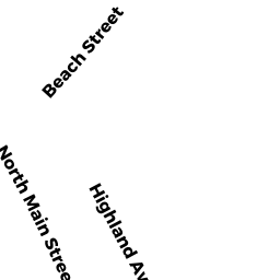
Property Used for Postal Services owned by POMPEO ROGER A - 11 NORTH MAIN ST
Single Family Residential owned by NOON NICHOLAS W - 23 NORTH MAIN ST
Rectory or Parsonage owned by FIRST PARISH IN COHASSET - 31 NORTH MAIN ST
Single Family Residential owned by CAROLYN J. LAUDIEN 2020 TRUST LAUDIEN, CAROLYN J. - 25 NORTH MAIN ST
Single Family Residential owned by FEGREUS EDWARD E JR